Living in Kadıköy: areas, metro and ferries
Living in Kadıköy means a Marmara coastline, a busy ferry pier and 21 mahalle with very different streets. This guide shows how the district is laid out, how you travel in and out, and what to check when you choose a flat.
- 458,573People living in Kadıköy at the end of 2025
- 21Mahalle named on the title deeds
- 25km²District area on the Anatolian shore
- 21kmOf Marmara coast, Haydarpaşa to Bostancı
Where Kadıköy is, and how the district is shaped
Kadıköy is the Asian-side district that faces the Sea of Marmara from the north. Üsküdar borders it to the north-west, Ataşehir to the north-east and Maltepe to the east. Part of its shore faces the historic peninsula across the water.
The district covers 25 km² and had 458,573 residents at the end of 2025. About 21 km of coast run from the bay of Haydarpaşa to Bostancı, past the capes of Moda and Fenerbahçe and the bay of Kalamış. The D-100 highway marks the northern edge. Seven mahalle north of that road left in 2008 to form the Ataşehir district, which is why Kadıköy is smaller than it used to be.
The name means “village of the judge” and is thought to come from Kadı Hızır Bey, who was given the jurisdiction after the conquest of 1453. Long before that, the town was Chalcedon, where the Council of Chalcedon met in 451 AD, and people had settled the area in prehistoric times.
Notices, events and local services are published by Kadıköy Municipality.
Mahalle or semt? How to read a Kadıköy address
A title deed names the mahalle, the official neighbourhood. Everyday speech uses the semt, the area people know by name. The two do not always match. Moda is a semt inside Caferağa mahalle, and Kalamış and Dalyan both lie within Fenerbahçe mahalle.
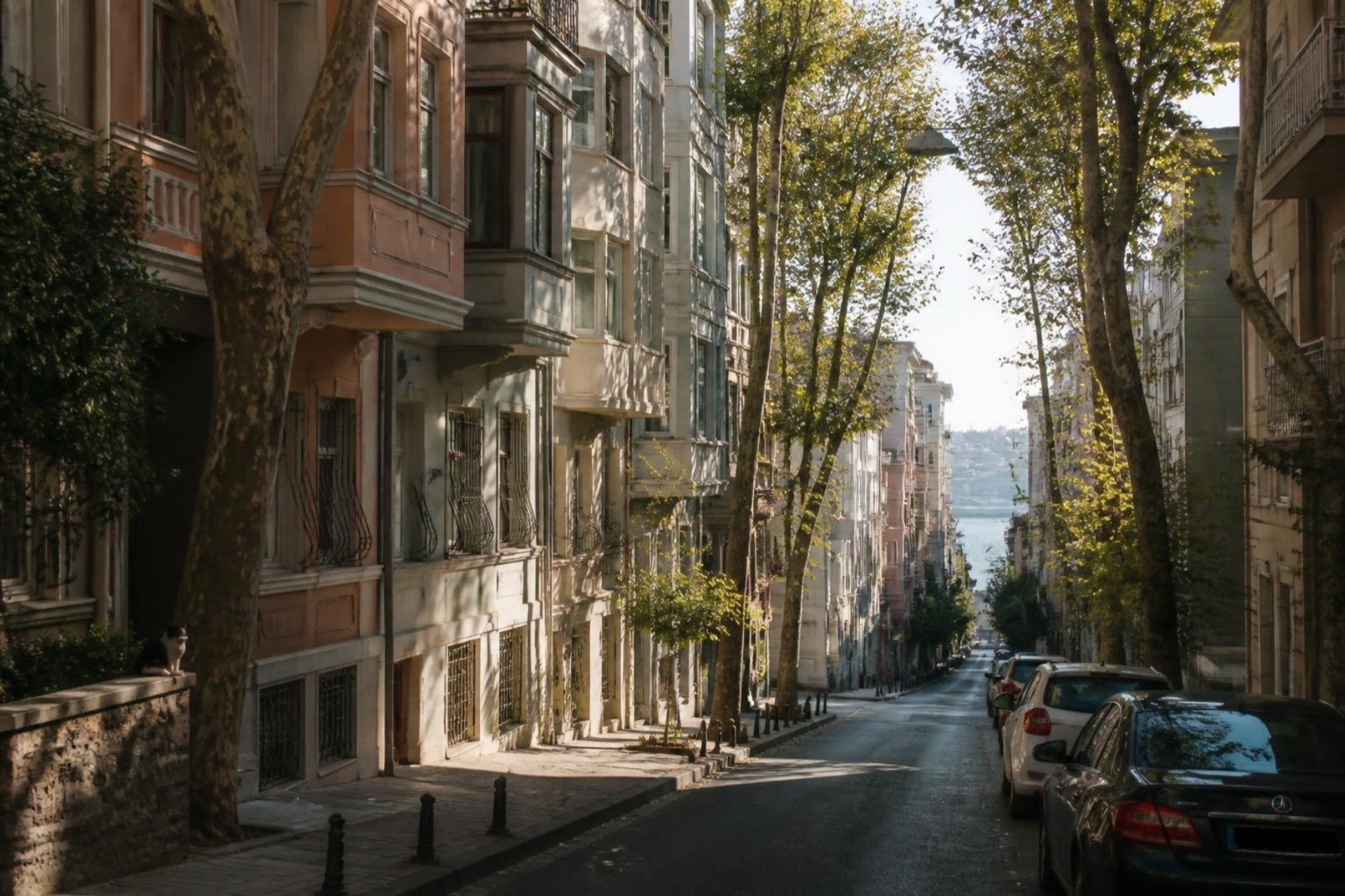
The historic core, with Çarşı, Yeldeğirmeni and Moda, spreads across Rasimpaşa, Osmanağa and Caferağa. So when an advertisement says “Moda”, ask which mahalle appears on the deed, because that is the name the Land Registry uses.
The 21 mahalle of Kadıköy on one table
Göztepe is the most populated mahalle and Kozyatağı comes second. Koşuyolu is the smallest. The counts below are from 2024 and add up to 462,189; the district total for 2025 is 458,573.
| Mahalle | Residents | Note |
|---|---|---|
| 19 Mayıs | 31,864 | |
| Acıbadem | 28,600 | |
| Bostancı | 32,415 | |
| Caddebostan | 20,209 | Seaside, on Bağdat Caddesi |
| Caferağa | 21,350 | Moda is a semt inside it |
| Dumlupınar | 10,170 | |
| Eğitim | 12,988 | |
| Erenköy | 34,438 | |
| Fenerbahçe | 20,571 | Includes Kalamış and Dalyan |
| Feneryolu | 25,300 | |
| Fikirtepe | 12,305 | Urban renewal area |
| Göztepe | 38,613 | Most populated |
| Hasanpaşa | 15,918 | |
| Koşuyolu | 6,660 | Smallest |
| Kozyatağı | 36,873 | Second most populated |
| Merdivenköy | 30,620 | |
| Osmanağa | 7,497 | |
| Rasimpaşa | 12,086 | |
| Sahrayıcedit | 30,112 | |
| Suadiye | 25,697 | |
| Zühtüpaşa | 7,903 |
Pier, Çarşı and Moda
The central market, Çarşı, sits right beside the ferry quay, with a large bus and minibus terminal next to it. On Bahariye Caddesi, a pedestrian street with cinemas and theatres, stands the Süreyya Opera House of 1927. The bronze bull at Altıyol, made by Isidore Jules Bonheur in 1864, came to the district in 1969 and moved to its present spot in the 1990s.
Moda İskelesi, the pier designed by Vedat Tek in 1917, reopened in 2022 as a library and café. A nostalgic tram links Kadıköy and Moda and has run again since 2003. Moda Coastal Park offers wide lawns, a rocky shore and open sea views, and neighbours use it as a meeting place.
The seaside mahalle, from Moda to Fenerbahçe
East of Moda, the coast belongs to Fenerbahçe, Caddebostan and the mahalle behind them. Fenerbahçe is a peninsula named after its lighthouse of 1856. Kalamış lies along its north-west shore with a yacht marina in the bay, and Dalyan curls round the south-east side.
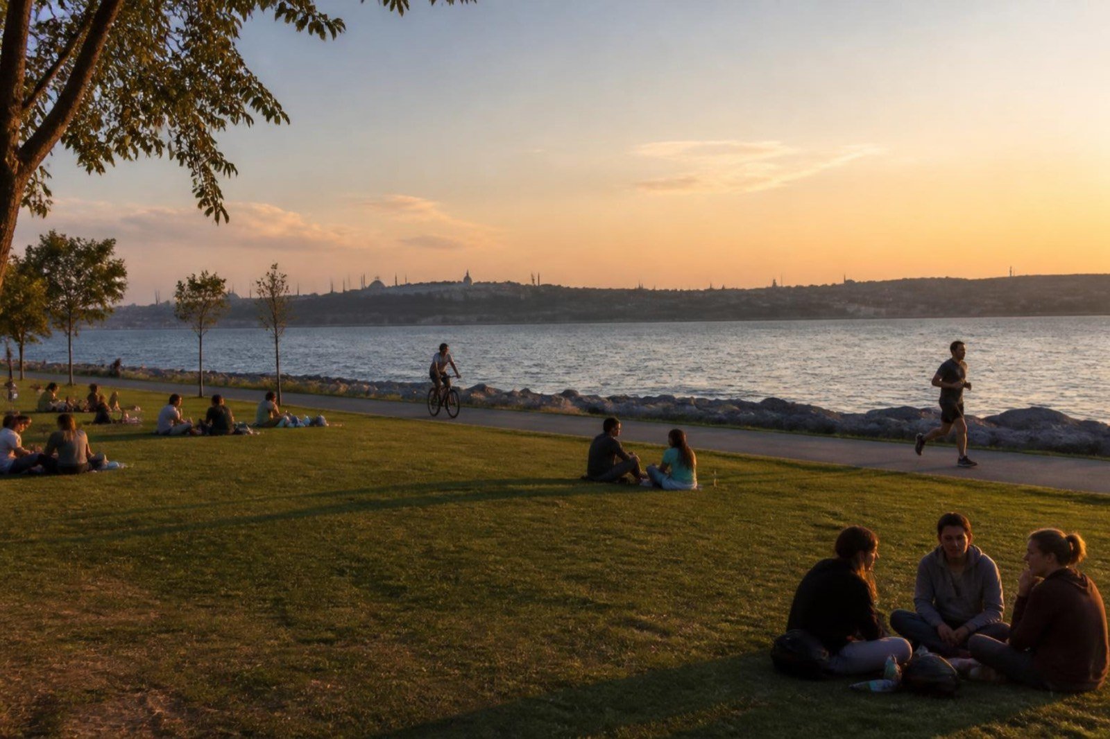
Caddebostan has its own seafront and the Caddebostan Kültür Merkezi, a cultural centre. Göztepe takes its name from a hill with the tomb of Gözcü Baba. Göztepe Parkı, about 10,000 m², stands on Bağdat Caddesi, although it lies technically outside the mahalle boundary. The avenue itself runs through the seaside mahalle.
Apartment blocks now fill most of this coast, but it was not always so. From the late 1960s the summer-house character of the seaside mahalle faded. The 1965 Condominium Law and a 1972 zoning plan allowed dense building, the 1973 Bosphorus Bridge tied the district closer to the other bank, and the coast road followed in 1984–87.
Our comparison of the best areas in Kadıköy: Moda, Caddebostan, Fenerbahçe, Göztepe and Fikirtepe →
Rail, metro and ferries
Kadıköy works as a transport hub. The cards below list the lines that serve it. M4 and M8 stations near a boundary are named without saying which mahalle they stand in, because the sources do not agree.
Marmaray Commuter rail from Gebze to Halkalı through the Bosphorus tunnel, with seven stops between Ayrılık Çeşmesi and Bostancı in Kadıköy
- Ayrılık Çeşmesi
- Söğütlüçeşme
- Feneryolu
- Göztepe
- Erenköy
- Suadiye
- Bostancı
M4 Metro that starts at the Kadıköy terminus and runs on to Sabiha Gökçen Airport; the first eight stops are shown
- Kadıköy
- Ayrılık Çeşmesi
- Acıbadem
- Ünalan
- Göztepe
- Yenisahra
- Kozyatağı
- Bostancı
M8 Bostancı–Parseller metro, opened in January 2023; it meets the M4 at Kozyatağı and Marmaray at Bostancı
- Emin Ali Paşa
- Ayşekadın
M12 Göztepe to Kâzım Karabekir, 13 km with 11 stations, under construction Planned for December 2026
- 60. Yıl Parkı
- Tütüncü Mehmet Efendi
- Sahrayıcedit
- Yenisahra
Metrobus Bus rapid transit whose Anatolian-side terminus is next to the Söğütlüçeşme Marmaray station
- Söğütlüçeşme
Ferry Passenger piers in the district, west to east; the Moda pier serves the Moda–Karaköy–Kabataş line
- Haydarpaşa
- Kadıköy
- Moda
- Bostancı
Stops are listed from the Kadıköy end. The M12 is planned and not open yet.
Marmaray crosses the Bosphorus in a 1.4 km immersed tunnel. The tunnel section opened on 29 October 2013, and the full line from Halkalı to Gebze followed on 12 March 2019. Seven of its stops, from Ayrılık Çeşmesi to Bostancı, are in Kadıköy.
The M4 opened between Kadıköy and Kartal on 17 August 2012. Today it runs 33.5 km with 23 stations to Sabiha Gökçen Airport. Kadıköy, Ayrılık Çeşmesi, Ünalan and Göztepe stations lie below sea level, and the line meets Marmaray at Ayrılık Çeşmesi and the M8 at Kozyatağı.
The M8 between Bostancı and Parseller opened on 6 January 2023, and Emin Ali Paşa and Ayşekadın are its stations in the district. The M12 will run from Göztepe to Kâzım Karabekir through 11 stations, with an interchange to Marmaray at Tütüncü Mehmet Efendi. Its opening is planned for December 2026, so treat that date as provisional.
The Metrobus ends on the Anatolian side at Söğütlüçeşme, beside the Marmaray station of that name. By road, the D-100 meets the O-2 towards the Fatih Sultan Mehmet Bridge at Kozyatağı and the O-1 towards the 15 July Martyrs Bridge at Uzunçayır.
Kadıköy pier is the main ferry interchange. Boats run to Karaköy and Eminönü, Beşiktaş, Kabataş, Sarıyer, Ortaköy via Üsküdar and the Princes’ Islands, and a Haliç line reaches Eyüpsultan. Sea buses link Bostancı, Kadıköy, Yenikapı and Bakırköy. Times and fares change, so we quote none: see Şehir Hatları for ferries, Metro İstanbul for the metro and TCDD Taşımacılık for Marmaray.
Haydarpaşa station opened in 1872, and the present neoclassical building by German architects went up in 1906–09. Suburban trains stopped on 19 June 2013, and the building is under restoration. No reopening date has been fixed, so we do not give one.
How to get to Kadıköy: ferry, M4 metro and Marmaray, explained for residents →
Fikirtepe and the new towers
Fikirtepe is a small mahalle of 12,305 residents (2024) on 0.53 km². It lies beside the D-100, with Hasanpaşa and the O-1 ring road to the west and Merdivenköy to the east. Prehistoric settlement here gave the Fikirtepe culture its name, although the mound itself was later built over.
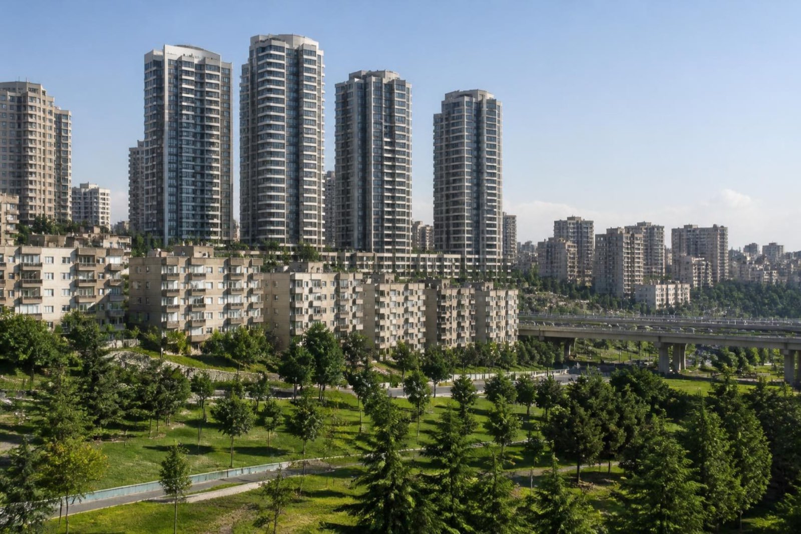
The Council of Ministers declared the mahalle a riskli alan (risk area) on 9 May 2013. In February 2021 the ministry divided it into three stages and drew new plans. Courts have annulled earlier plans more than once, so the paperwork for a flat deserves extra care.
The ministry says that in May 2026 the first stage had 11,729 independent units complete, with about 25,000 people due to move in. These are the ministry’s own figures, and we have not checked them independently.
Fikirtepe urban transformation: the timeline and a checklist before you sign →
Campus, hospital and museums
Most of Marmara University’s buildings stand in Kadıköy, including the Haydarpaşa campus. The Göztepe Prof. Dr. Süleyman Yalçın City Hospital is a public hospital in the district. For culture, the Barış Manço Müzesi, housed in the Whittall Köşkü of 1900, is in Moda, the Kazım Karabekir Paşa Müzesi is in Erenköy, and the Istanbul Toy Museum, which opened in 2005, is in Göztepe.
Which part of Kadıköy suits you?
Begin with the journey you make most often. After that, think about the view and the age of the building.
Pier, Çarşı and Moda
For ferries, the market and walks on foot. Established streets mean you should ask about the building’s age and its deed.
The seaside mahalle
For the coast, Bağdat Caddesi and Marmaray at Göztepe and Erenköy. Decide whether sea air or a short walk to the station matters more.
Inland, along the M4 and M8
For a rail commute away from the water, with stations from Acıbadem to Kozyatağı. The M12 would add a link at Göztepe once it opens.
Fikirtepe and the renewal areas
For new towers beside the D-100. Check the papers of each flat, and read our guide before you view.